Kansas City Soil Conditions for Construction & Sitework
The geotechnical reference for every project in the KC metro — Wymore-Ladoga clay, limestone bedrock in southern Johnson County, Missouri River alluvium, frost depth, and what all of it means for foundations, slabs, and sub-grade preparation.
01 — Overview
KC Soil Overview
Kansas City sits on some of the most challenging construction soils in the Midwest. The dominant near-surface soil across the metro is the Wymore-Ladoga clay complex — a fat, high-plasticity clay that covers Jackson, Clay, Cass, and northern Johnson counties, with 60–80% clay content and a very high shrink-swell rating. The same clay that makes foundations and slabs risky without proper preparation is also what makes sitework in KC a precision game. It is workable — crews have built on this ground for a century — but it is unforgiving of any contractor who treats it like neutral dirt.
Two major exceptions break up the clay picture. In southern Johnson County — Olathe, Gardner, Spring Hill — limestone bedrock sits within 3–15 feet of the surface, and rock excavation becomes a routine budget line item. Along the Missouri River corridor — Riverside, Parkville bottoms, the KCK Fairfax district, Sugar Creek, the North Kansas City bottoms — alluvial sand, silt, and clay deposits behave completely differently from upland clay. They drain well but require dewatering during excavation and carry FEMA floodplain obligations.
Every phase of sitework — clearing, earthwork, grading, utility trenching, erosion control — has to be tuned to which of these soil regimes the project sits in. A compaction approach that works in Lenexa will not work in Gardner. A foundation detail that works in Overland Park will not work in Riverside. This page is the reference every GC, developer, and property owner should read before bidding or staking a project in the KC metro.
02 — Soil Conditions by Area
Soil Conditions by County and Area
The table below maps dominant soils across the KC metro by county and area, with USCS and AASHTO classifications, the key construction challenge each zone presents, and typical depth to bedrock. Use it as a first-pass reference when scoping a project — then confirm with a site-specific geotechnical report before committing to foundation design or sitework bid numbers.
| Area | Dominant Soil | USCS Class | AASHTO Class | Key Challenge | Depth to Bedrock |
|---|---|---|---|---|---|
| Jackson County (KCMO, Independence, Blue Springs, Raytown) | Wymore-Ladoga clay | CH / CL | A-7-6 / A-6 | High shrink-swell, 60–80% clay, narrow compaction moisture window | 15–30 ft |
| Johnson County north (Overland Park, Shawnee, Lenexa, Prairie Village) | Wymore-Ladoga clay over deeper bedrock | CH / CL | A-7-6 / A-6 | Heavy clay — same shrink-swell behavior as Jackson County | 10–30 ft |
| Johnson County south (Olathe, Gardner, Spring Hill) | Clay over limestone bedrock | CH over rock | A-7-6 | Shallow bedrock, rock excavation commonly required | 3–15 ft |
| Clay / Platte County (Liberty, Smithville, Platte City, Parkville upland) | Wymore clay + loess on uplands | CH / ML | A-7-6 / A-4 | Erosion-prone loess, expansive clay, river-bluff conditions | 20–40 ft |
| Wyandotte / Leavenworth County | Loess silt + clay over glacial till | ML / CL | A-4 / A-6 | Erosion-prone bluffs, variable bearing, collapsible loess when saturated | 5–30 ft |
| River corridors (Riverside, Parkville bottoms, KCK Fairfax, Sugar Creek) | Alluvial sand, silt, and clay | SM / SC / CL | A-2 / A-4 / A-6 | High water table, dewatering required, flood risk | 40–80+ ft |
03 — Frost & Seasonality
Frost Depth & Seasonal Impact
KC metro frost depth is 30–36 inches. Local building codes adopt 30 inches as the standard adopted depth; 36 inches is used as a safety margin on commercial work and is the minimum water line burial depth in Missouri. Kansas cities commonly use 30 inches for water line cover. Foundation footings bear below the frost line by code.
Excavation in December through February routinely hits frozen ground in the top 30–36 inches. Frozen clay is workable but slows production significantly, and any trench bottom left open overnight can freeze hard enough to require re-excavation before pipe can be laid. Winter concrete pours against frozen ground risk frost heave and have to be managed with blankets, hoarding, and accelerated mixes.
Spring (March through May) is the single worst window for KC sitework. Wymore clay saturates after even moderate rain and becomes unworkable — not just wet, unworkable — for 2–5 days depending on sun and wind. Realistic spring schedules in KC assume 40–50% weather loss. Late summer and early fall (August through October) are the most reliable production windows.
04 — Expansive Clay
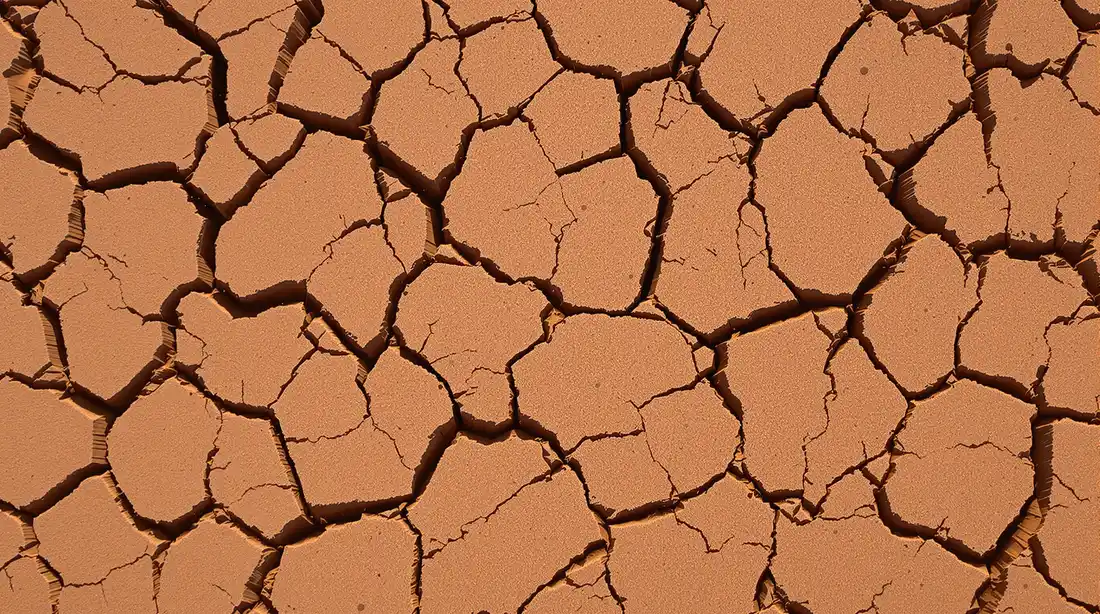
Expansive Clay — The KC Challenge
Wymore clay's shrink-swell behavior is the single biggest geotechnical challenge in the Kansas City metro. When the clay absorbs water, it expands. When it dries out, it contracts. Over a full wet-dry cycle, the ground surface can move one to two inches vertically, and the movement is not uniform across a site — it follows moisture gradients, tree roots, and drainage patterns. This is the chemistry that cracks residential foundations, heaves parking lot slabs, tilts retaining walls, and breaks sidewalks in neighborhoods all over KC.
Sitework mitigates expansive clay through four tools. First, moisture conditioning during fill placement — bringing the clay into the optimum moisture window (typically 16–20% for modified proctor) before compacting. Second, compaction control held within about 2% of optimum moisture and verified with a nuclear density gauge, not guessed. Third, positive drainage away from structures — minimum 2% slope across paved areas, 2–5% across landscape, verified with a rotating laser before sign-off. Fourth, granular backfill (AB-3 aggregate or clean rock) against foundation walls and in the pipe zone of utility trenches, with native clay used only in the upper trench zone.
A foundation poured on poorly prepared clay will crack. A parking lot poured on clay sub-grade without adequate base rock will heave. The sitework is the concrete warranty. This is the reason Ford Concrete's dual sitework-and-concrete expertise matters — the people preparing the sub-grade know exactly what the concrete on top needs, because they are the ones pouring it.
On residential pool installation, the same clay chemistry that threatens foundations and slabs is exactly why fiberglass pool shells handle KC ground better than gunite. A fiberglass shell flexes with minor ground movement; a rigid gunite pool cracks. See our pool installation page for the full explanation.
05 — Bedrock
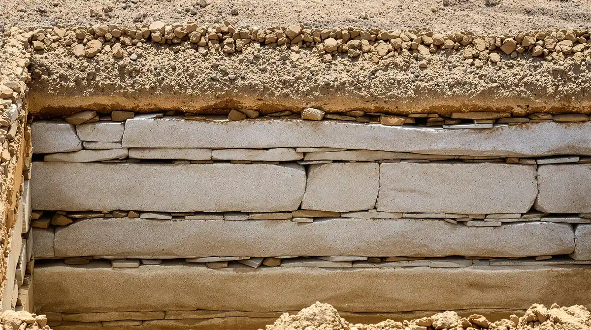
Bedrock in Southern Johnson County
Southern Johnson County sits on shallow limestone bedrock — primarily Bethany Falls limestone and Argentine limestone, both layered sedimentary formations that can show up within a few feet of the ground surface. Typical depths are 3–6 feet in Olathe, 4–8 feet in Gardner, and 5–10 feet in Spring Hill. Any project south of roughly 135th Street in Johnson County should assume rock will be encountered and carry a contingency for it.
Three methods move rock in KC sitework. Ripping with a large dozer (D8 or equivalent) pulling a single-shank or three-shank ripper works on weathered, fractured rock and shallow limestone benches. Hydraulic breaker — a hoe-ram mounted on an excavator — handles solid limestone that will not rip, and is the standard method for any substantial rock removal on a KC commercial site. Blasting is rare inside the metro because of vibration and neighbor considerations, and it is almost never used on standard building pad excavation.
Rock excavation is priced as a separate line item in any honest bid and commonly shows up as an allowance with a capped dollar amount until the actual rock quantity is known. For the full cost breakdown, see the sitework cost guide.
06 — River Corridor
Missouri River Alluvial Zone
The Missouri River alluvial corridor runs through the KC metro in a band that affects Riverside, Parkville river bottoms, the KCK Fairfax industrial district, North Kansas City bottoms, Sugar Creek, and parts of the Berkley Riverfront redevelopment zone downtown. The soils in this corridor are alluvial deposits — layered sand, silt, and clay dropped by flood cycles over millennia — and they behave fundamentally differently from the Wymore clay that dominates the rest of the metro.
Dewatering. The water table in alluvial zones typically sits 5–15 feet below grade and rises with river stage. Excavations that reach the water table have to pump continuously during construction, which adds well point systems, sump pumps, and discharge permitting as separate cost items. Dewatering alone can run tens of thousands of dollars on a mid-sized commercial excavation in the river bottoms.
FEMA floodplain compliance. Most of the Missouri River alluvial zone sits inside the 100-year or 500-year regulated floodplain. FEMA compliance drives minimum finished floor elevations, flood-resistant construction standards, and in some cases Army Corps of Engineers Section 404 permit review. Building pads are commonly elevated above the regulatory flood elevation with imported structural fill, which is itself a major line item.
Soil bearing variability. Alluvial soils are layered and heterogeneous. A boring at one corner of a building footprint can show a very different profile from a boring 100 feet away. Foundation design in the river corridor relies on more boring coverage, deeper geotechnical investigation, and in many cases deep foundations (piers or piles) rather than shallow footings. Any project in the alluvial corridor should start with a thorough geotechnical investigation before sitework bids are finalized.
KC Soil Conditions — FAQs
What kind of soil does Kansas City have?
The dominant near-surface soil across the Kansas City metro is the Wymore-Ladoga clay complex — a fat, expansive clay with 60–80% clay content. In USCS terms it classifies as CH (fat clay) or CL (lean clay). In AASHTO terms, A-7-6 and A-6. Wymore-Ladoga dominates Jackson County, northern Johnson County, Clay County, Cass County, and most of the metro outside a few specific zones. The two major exceptions are southern Johnson County — where clay gives way to shallow limestone bedrock within 3–15 feet of the surface — and the Missouri River corridor, where alluvial sand, silt, and clay replace the upland clay.
How deep is the frost line in Kansas City, Missouri?
Kansas City metro frost depth is 30–36 inches. Local building codes adopt 30 inches as the standard, and 36 inches is used as a safety margin on commercial work. Water lines have to be buried below the frost line — minimum 36 inches of cover in Missouri and typically 30 inches in Kansas, though cities verify individually. Foundation footings must bear below the frost line. Excavation in December through February often hits frozen ground above that depth, which slows production and adds cost.
Why is Kansas City clay so hard to work with?
Wymore clay has a very narrow moisture window for achieving compaction. Too wet, and it pumps and deforms under a roller instead of compacting. Too dry, and it breaks into hard clods that leave voids in the fill. Optimum moisture content for modified proctor compaction is typically in the 16–20% range, and field crews have to test moisture before compacting, then either dry the soil by spreading and disking or add water with a water truck to hit the window. On top of that, Wymore clay swells 25–35% from bank to loose when excavated, and the finished grade can shift one to two inches seasonally as the clay expands and contracts with moisture. It is workable — but it punishes contractors who do not respect the chemistry.
When does limestone bedrock start in Johnson County, Kansas?
Limestone bedrock depth in southern Johnson County typically runs 3–15 feet below grade. Olathe projects commonly encounter rock at 3–6 feet. Gardner runs 4–8 feet. Spring Hill 5–10 feet. The formations are primarily Bethany Falls limestone and Argentine limestone — both layered sedimentary rock that can sometimes be ripped with a D8 dozer when weathered, but solid limestone typically requires a hydraulic breaker (hoe-ram) on an excavator. Any project south of roughly 135th Street should carry a rock excavation contingency. Further north in Johnson County — Overland Park, Shawnee, Lenexa — bedrock sits deeper, typically 10–30 feet, and rock is less of a concern for typical building pads.
Can you build on Wymore clay without special foundations?
Yes, but you have to respect what the clay does. The standard response to expansive clay in the KC metro is a combination of moisture conditioning during fill placement, compaction control held within about 2% of optimum moisture, positive drainage away from the structure with at least a 2% minimum slope across paved areas, and a granular drainage layer against any foundation wall to prevent hydrostatic pressure. Most commercial foundations in KC are conventional spread footings or slabs on grade with these mitigations. Post-tension slabs, deep piers, and engineered mat foundations are used on specific projects where the design loads or soil conditions warrant them — but they are not the default. The default is good sitework done by a crew that knows the clay.
What is the best time of year to compact Kansas City clay?
Late summer through early fall — August into October — is typically the best compaction window in the KC metro. Clay moisture has had the full growing season to dry down, ambient temperatures support evaporation, and fewer days are lost to rain. Spring (March–May) is the worst window because Wymore clay becomes unworkable after rain and sites commonly lose 40–50% of their workdays to weather. Summer (June–August) is reliable on the calendar but extreme heat can dry clay beyond the optimum moisture range, requiring a water truck to re-wet the fill before compacting. Winter is possible but frost, frozen lifts, and shorter daylight all add cost and complexity.
How does Missouri River alluvium affect construction in Riverside?
Missouri River alluvial soils behave fundamentally differently from the Wymore clay that dominates the rest of the metro. They are sand, silt, and clay layers deposited by flood cycles, they drain well, and they can carry surprisingly high bearing loads — but they sit on a high water table that requires dewatering during excavation, they can liquefy or pipe under hydrostatic pressure, and they are inside the FEMA regulated floodplain in most of the cities where they dominate (Riverside, Parkville bottoms, KCK Fairfax district, Sugar Creek, North Kansas City bottoms). Floodplain sitework also commonly triggers Army Corps Section 404 review and elevated building pad requirements. Riverside commercial projects almost always carry a dewatering line item and a floodplain compliance line item.
What USCS class is typical for Kansas City clay?
Wymore clay classifies as CH — fat clay — in the Unified Soil Classification System when tested per ASTM D2487. Ladoga clay, which is associated with Wymore across the metro, classifies as CL — lean clay. The AASHTO soil classification is A-7-6 for Wymore and A-6 for Ladoga. Both classes carry high plasticity indices and high shrink-swell ratings, which is why KC clay is classified as OSHA Type C soil once it has been disturbed — the least stable category and the one that drives the flattest sloping angles and the most conservative protective systems in trenching work.
Building on KC Clay, Rock, or River Bottoms?
Eleven years of commercial and residential sitework on every soil regime in the KC metro. Send us the civil plans and geotech report — we will build a bid that respects what is actually in the ground.
11 Years Commercial Experience · Licensed & Insured
Ready to Get Started?
From call to concrete — the fastest in KC.
Get a free, no-obligation estimate for your concrete project. We serve the entire Kansas City metro — call (816) 721-1699 or request your estimate online.